Marøy fyrlykt og losstasjon Traditional Geocache
bjornda: Hei!
Da arkiveres denne cachen. Den hadde et fint liv lenge, men det ble
vanskelig med vedlikehold etterhvert. Takk til alle som singte nedom
her for å logge et funn på denne. fint sted. Håper noen andre vil legge
ut en ny cache her!
Mvh
Bjørn
Marøy fyrlykt og losstasjon
-
Difficulty:
-

-
Terrain:
-

Size:  (small)
Please note Use of geocaching.com services is subject to the terms and conditions
in our disclaimer.
[Nor] Cachen er en metallsylinder med logbok, blyant og plass til
små byttegjenstander. Settes tilbake med åpningen NED.
[Eng] The cache is a small metal cylinder with a log book, pencil
and some small trade items. Replace with opening facing DOWN
please.
Marøy lighthouse is located on Marøy island, just west of Harøya.
On this small island, 4 families were living.
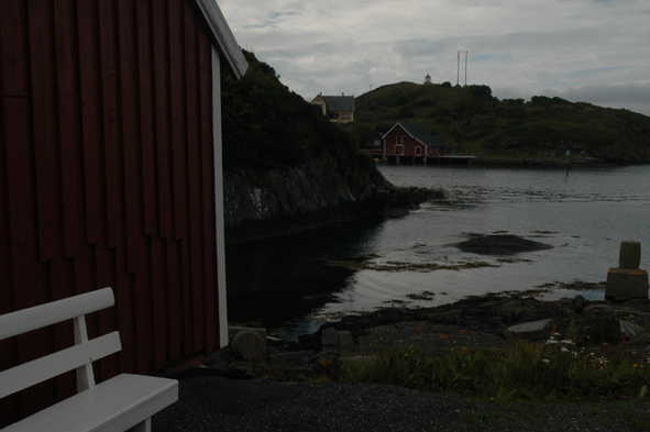
Marøya with the lighthouse.
The cache is located on the Harøya, since there is no bridge to
Marøya. On Marøya, there was also a ship pilot station
(Los-stasjon). The pilotes main task was to aid ships to safely
navigate through dangerous waters.Normally, the pilots from the
Sandøy county (e.g. Marøya, Harøya and Ona pilot stations) boarded
the ships outside of the costline and helped the ships all the way
to Kristiansund or Trondheim. They then had to arrange for the
return trip (either by land or sometimes by buying an old boat to
bring home). Each station had several pilots, and once a ship
signalled need for help (by way of a flag or a gunshot), the pilots
would fight to get to get to the ship first and win the commission.
On the building close to the cache hide, there is an information
board about the historic ship pilot service that was present
here.
The lighthouse was erected in 1915. The lighthouse covers ca 250
degrees, divided into 14 sub-sectors with red, green and white
light. The light is 28 meters above sea level, and shines with a
characteristic occulting pattern: Oc(2) 8s, that means, constant
light with two short dark periods every 8th second.
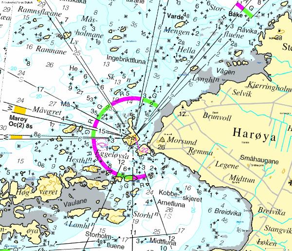
Map of Marøya lighthouse with surrondings.
Additional Hints
(Decrypt)
[Nor] Vaav shaqnzrag, 1z sen uwøear, onx yvgra fgrva
[Eng] Vafvqr shaqnzrag, 1z sebz pbeare, oruvaq fznyy fgbar