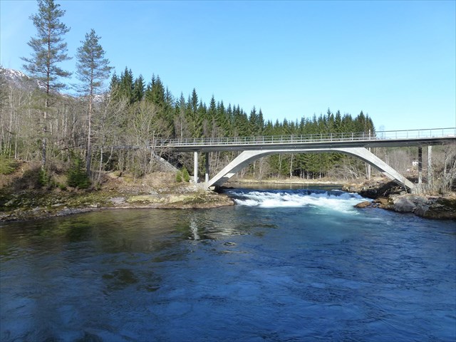
Om cachen: GPS-en kan rote litt pga. brua, men du skal altså under ho. Cachen krever litt lett klatring. Du treng ikkje flytte på noko for å finne boksen.
Holsabrua kryssar Jølstra like nedanfor Stakaldefossen kraftstasjon såvidt inne i Førde kommune. Frå brua kan ein sjå inn til grenda Stakaldefossen og Statnett sin transformatorstasjon på 420 kV-linja Ørskog–Fardal og tunnelen inn til Jølstra Kraftverk under Halvgjerda. Ein kan og sjå nokre av «monstermastene» som går inn til dette knutepunktet i linja.

Nedanfor brua på nordsida er det ein bålplass kor ein og kan ta seg eit bad om vannstanden ikkje er for høg. På austsida av brua er det ein avkjørsel til eit industriområde kor du for tida lett skal finne parkeringsplass kor det går ein sti bort til denne bålplassen. Sørvest for brua kan ein sjå restane av den forrige brua som kryssa Jølstra her.

About the cache: The GPS coordinates might be a bit shaky due to the bridge. Getting under the bridge requires some light climbing. You don't have to move anything to find the cache.
This bridge crosses the river Jølstra just downstream from the Stakaldefossen hydropower station. From these coordinates, you can see part of a large substation in a controversial 420 kV line crossing large parts of western Norway.
North of the bridge there is a campsite which also allows for a swim, if the water level is low. On the west side of the bridge, there is an exit that leads to the easiest trail for getting to this campsite. Southwest of the bridge, you can see remains of the previous bridge crossing the river here.