Bakkekletten 155 moh Traditional Geocache
-
Difficulty:
-

-
Terrain:
-

Size:  (small)
Please note Use of geocaching.com services is subject to the terms and conditions
in our disclaimer.
Bakkekletten 155 moh
Cachen er ein lock-and-lock boks som inneheld loggbok, infoark, blyant og nokre bytteting.
Eng:The Cache is a lock-and-lock container. The Cache contains loggsheet, infosheet, pencil and some trading items.
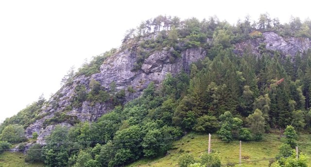
 Frå parkeringa kryssar vi fv 609 før vi tek til venstre inn på ein gammal kjerreveg under Kletten. Vi følgjer kjerrevegen gjennom ei grind og fram til eit vedlager. Her tek vi til høgre og følgjer ein traktorveg fram til der stien tek til venstre og stig bratt opp til eit utsiktspunkt mot nord. Deretter går vi gjennom lett skogsterreng til toppen der stien deler seg i to. Til høgre ligg utsiktspunkt rett over Holmedalsbygda. Til venstre finn vi stiens høgaste punkt (155 moh) og bålplassen. Tilbake same veg.
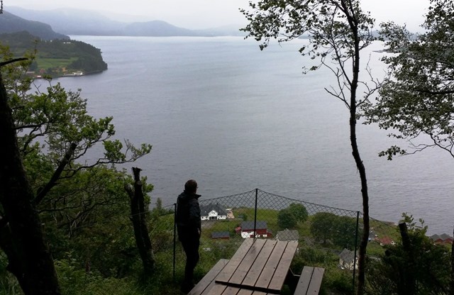
 From the car park you cross county road 609, before you turn left on the old cart road. Follow the cart road through the gate until you reach a wood log storage. From here you turn right and proceed on the tractor road until the trail turns left and continues in a steep asceding to the north-facing viewpoint. You continue the walk through a light wooded area to the top. Here the trail splits. To the right it leads to a viewpoint overlooking the village of Holmedal. To the left you will find the peak of the trail (155 masl.) and a fireplace. Return on the same trail.

Additional Hints
(Decrypt)
V uhyr onx gb fgrvare
Rat: Va pnir oruvaq gb fgbarf