 Hovsveien, Foto: André Karlsen
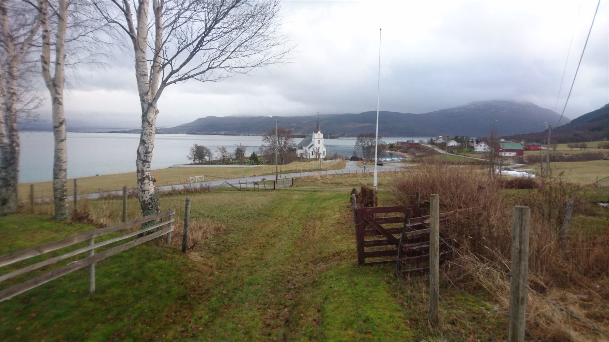
 Du går nå i vikingenes fotspor. Hovsveien går mellom høvdingsetene Hov og Hol, og har vært en transportvei i over 1000 år. Veien går gjennom et landskap med flere funn fra stein- og jernalderen. Tjeldsundet har vært et sted med bosetning i mange tusen år, med et stort og rolig innhav med lite grov sjø som gav gode muligheter til å livnære seg. Menneskene bosatte seg derfor på begge sidene av sundet, og det finnes funn av menneskelig bosetning langs hele kystområdet.
De første gårdene i området ble først anlagt allerede i eldre jernalder, men ble raskt utvidet til storgårder og mektige høvdingegods. En av disse gårdene var Hol gård, som lå langs Hovsveien mellom HGT 29 og denne cachen. På denne tiden var det vanlig å legge gravene et stykke unna bo- og jordbruksland. Derfor ble flere storbønder begravd oppe på Holshøgda, like ved der du står nå. Her er det god utsikt over ferdsel i sundet.
 You are now walking in the footsteps of the Vikings. Hovsveien runs between the chieftains seats of Hov and Hol, and has been a transport route for over a 1000 years. The trail goes through a landscape with several finds from the stone and iron age. Tjeldsundet has been a place of settlement for thousands of years, with a large and calm fjord with almost no rough sea which gave good opportunities to live, grow and hunt. People settled on both sides of the fjord, and there are several discoveries of human settlements along this coastal area.
The first farms in the area were built in the early Iron Age, but were quickly expanded to large farms and mighty chieftain seats. One of these farms was Hol that were located along the Hovsveien between HGT 29 and this cache. At this time, it was common to lay the tombs away from settlements and farmland. Therefore, people were buried up on Holshøgda, close to where you are standing now. Here you have a good view of the traffic in the strait.
Velkommen til HåloGeoTour (GT91)!
Dette er en serie med 40 geocacher plassert i Harstad og omegn. Nyttig informasjon om HålGeoTour kan du finne i
HGT 01, som er første cache i denne GeoTour-en. En oversikt over cachene som serien består av kan du finne her:
GT91. Her kan du laste ned passet du trenger for å fullføre GeoTour-en (om du ikke allerede har det), du kan se noen bilder, og du finner linker til våre sosiale mediekanaler. Del gjerne din opplevelse med oss i sosiale medier med #halogeotour
Welcome to HåloGeoTour (GT91)!
This is a series of 40 geocaches placed in and around Harstad. Useful information about the HåloGeoTour can be found in
HGT 01, which is the first geocache in this GeoTour. An overview of the geocaches this GeoTour consists of can be found here:
GT91. At this page you can download the passport you need to complete this GeoTour, you can see some pictures, and find links to our social media channels. We would love to see your experience shared in social media with #halogeotour!